First in a series of “archival” posts: my experience climbing North & South Arapaho peaks on July 31, 2010 in the Indian Peaks Wilderness of Colorado’s Front Range. At 13,500′, North Arapaho is the highest peak in the IPW. The ridge that spans the two summits is known as the “Arapaho Traverse” and it crosses above the Arapaho Glacier, which many argue is technically a mere “permanent snowfield”.
—
Last summer my family and I moved to Colorado. I was coming off six years of a soul-consuming staff job and several years transition into married life with kids, which is to say that at the time of the move fitness level was at an all-time low.
Although I’ve always been an avid hiker, I’d never thought so much about climbing mountains prior to moving here. Nothing like a view of the northern stretch of the front range from my backyard to inspire some wonder. Like, I wonder how high that one is? I wonder what the name of that one is? I wonder how hard it would be to get to the top of that one there, to the left, with the glacier in the middle? That’s Longs Peak over there—have to save that one for later…
After training through the winter and spring to build fitness I’d climbed progressively more challenging (for a rookie) peaks each weekend, including my first three 14ers of Princeton, Quandary & Pikes. After a few weeks of travel, I returned home and consulted “the list”, looking for something close by and maybe a little more technically challenging.
The recent hot temps have melted a lot of snow up high in only a couple of weeks–don’t really want to deal with snow on my first technical route–so it seems like an ideal time to have a go at a pair of peaks which, visible from the street in front of my house, have been inspiring the imagination for over a year: South & North Arapaho.
My scrambling experience has thus far has amounted to some very casual bouldering amongst the Flatirons, annual April sorties up and over the endless Flintstones-esque piles of monzogranite in Joshua Tree National Park, and childhood explorations of the rugged coastline of Rhode Island’s Narragansett Bay. A mix of anxiety and excitement creep in as I consider the potential difficulty of the traverse (since learning it’s meaning in a mountaineering context, I have always thought the word “traverse” to be on the weak side of action verbs, given what it’s meant to describe) airily brimming over the top of the Arapaho Glacier…I mean, snowfield.
I hit up a few hiking buddies but everyone is out of town for the weekend, so I am going solo on my first official attempt at Class 3. To compensate, I prepare, or more likely over-prepare, reading every route description and trip report, examining every photo, hoping that there will be a few people on the route to compare notes, or shadow if need be. I won’t deny that cruising past the ill-prepared masses on the few popular 14ers I’ve done has been a cheap little ego boost, but by the quality of the climbers authoring the route descriptions and trip reports of North Arapaho, I can tell that I’m likely to be the punter this time around.
—
4am comes fast and I am unsure as to whether or not I actually fell asleep at any point during the night. For a moment, as a Tylenol PM river of fatigue courses through my head, I think “no way.” But I remind myself that when the temptation to blow something off rears, it’s best just to turn off the brain and get out the door, knowing that I’ll feel better soon.
Sure enough, an hour later I am cruising up the 4th of July road blasting some 70’s Smooth FM Gold disc a friend gave me and dodging nasty, pointed rocks which are intent on ripping out the underside of my ill-suited Acura. Somewhere along the way, I have supposedly passed through the small town of Eldora, although I never noticed because the streets are completely pitch black up here.
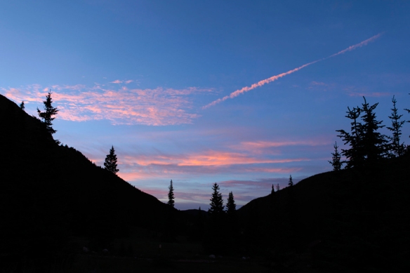
Once at the trailhead, it’s pretty quiet as civil twilight starts to break:
There’s one other live human being in the parking lot. We exchange hello’s and I’m off up the trail in the dawn gloom, past meadows and through dark thickets of forest. As the morning begins to brighten, I am able to get glimpses through the trees of the valley and I am awed—some of the finest scenery I have seen so far in Colorado. A waterfall crashes on the other side of the valley, pretty loud despite being what must be a couple miles away.
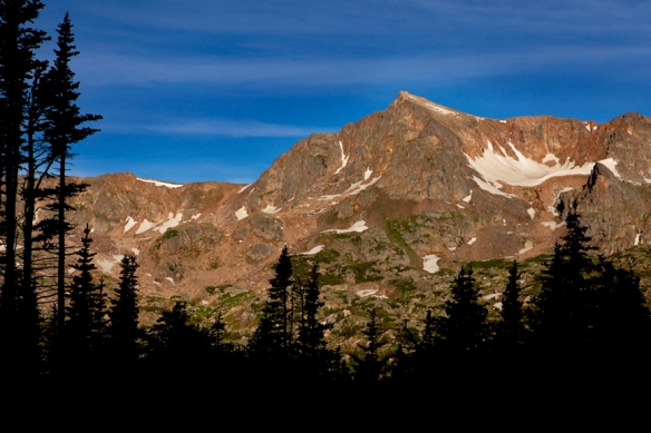
I pick my way across a few streams and break into the open as the sun lights up Mount Neva to the West:
The quality of the trail is great and the gradient pretty gentle. I reach the junction with the Arapaho Saddle trail and swing right just before the 4th of July Mine in a basin surrounded by high peaks on three sides. I am too busy marveling at the luck of the miners to have discovered riches in this amazing place to even bother taking a photo. Crossing a few more streams, I leave the trees and move up some long switchback sections over the tundra.
The summit of South Arapaho comes into view:
As I’m taking the photo, two other hikers pass. They’re paired up and each has a climbing helmet dangling off their packs:
Smart guys. I’d held a climbing helmet in my hand at the shop not a week before but didn’t pull the trigger. Solo and no helmet. The punter, indeed.
Soon I’m up to the saddle and North Arapaho and the glacier finally appear:
It looks so close that I can reach out grab it, but it ain’t!
The final pitch to South Arapaho is steeper and more rocky, but pretty short. After a brief rest at the top where I eat a bar and examine the ridge for bit, I tighten my bootstraps and begin the traverse. Although I take a few photos along the way, this part of the route is pretty well covered in previous trip reports. Besides, I find most of my attention be absorbed in trying to identify the route amongst the chaotic jumble of rock.
The initial sections are easy with just a few minor scrambles and almost no exposure as I stay mostly to the left side/west of the ridge. I come upon the two climbers who passed me earlier and they are scaling the well-known slab that forms the crux half-way across the traverse. The initial block of the slab is short but has only a few fingernail-width holds. After two other climbers top out, they turn to watch me. I grab tightly, commit and in two quick pull-steps I am over the block and then quickly up the rest of the slab. Not so bad, but at this point I am glad to have worn my Trango’s as the sticky toes and stiff soles made easy work of the thin placements.
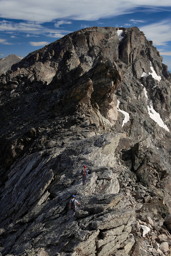
Now on top of the gendarme, I get a good view of the second-half of the traverse, as the other climbers move on below. Which way through?
From here on out things get confusing. Seemingly gone are the orange-painted arrows which marked several of the initial sections of the route and I find myself slowing and stopping more frequently to scope out the route ahead, often seeing nothing obvious. Here the exposure to the right over the glacier becomes more pronounced and soon I reach a sharp drop-off in ridge (visible in the above photo just ahead of the climbers) After about of second considering the possibility of repelling the overhang by hand (hah!), I realize it’s futile. The way is shut.
Backtracking a bit I end up taking the lesser of two evils and down-climbing some sketchy slabs off the left side onto loose and generally unfriendly terrain. I stumble and fight forward about 100 feet off the ridge for a while until becomes apparent that I’m totally off route. At one point some loose rock slides out from under me and my right ass cheek lands squarely on the sharp edge of a boulder. Yee-ouch, that’s gonna leave a mark.
The summit block is close now and there is no obvious route to the top, so I pull the route description, copied from my dog-eared edition of Gerry Roach’s Colorado’s Indian Peaks, out of my pocket and look for “a gully descending southwest from the summit plateau.” I sigh. Dammit–there are at least three gullies that fit this description as far as I can see. But, reaching the two gullies to the right appears to be inconvenient at best, given the mass of vertical rock between me and them, so the choice is pretty much made for me.
I begin to pick toward the left-hand gully. I would figure out on the way back that after the down-climb and short traverse to avoid the drop-off, the actual route immediately regains the ridge.
As it is, the gully proves to be the most difficult part of the day—steep, loose and very tight in places. I struggle upward and begin to feel the elevation and lack of sleep. There’s no wind and it’s pretty hot, which is a first for me up high. I’m sweating heavily and just as I begin to feel some frustration, I clear the top of the gully.
Obtaining the gentle summit plateau, I shuffle up to the mother of all summit cairns:
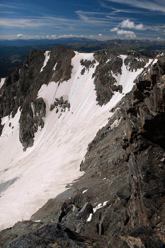
A fine view of the glacier from the opposing side:
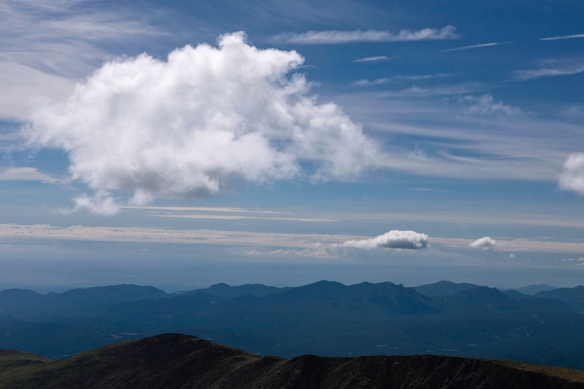
Later on I would have a conversation with someone who told me that people used to ski off the ridge and down the glacier before it was closed off as part of Boulder’s watershed. Looking at the vertical upper slope of the glacier, this sounds like utter insanity, but who knows. I notice the first puffy clouds forming in the east and I take a photo as they seem to be moving and expanding quickly. Time to head back.
The re-traverse is uneventful and takes me less than half the time of the outbound leg as the route seems much more obvious in this direction. Harsh reality when I have to acknowledge that my tendency to zone out on long hikes does not serve me well when route-finding is a constant concern. Semi-technical scrambling, exposure and obvious route conundrums seem to focus my concentration. More subtle but perhaps equally important route-finding doesn’t necessarily–something I’ll have to be more aware of and disciplined about in the future.
Up and over South Arapaho again and with weather moving in, I try for a lightening (no pun intended) ascent of the adjacent, unranked “Old Baldy”. Only 90 minutes after I photographed those small puffy clouds, both North & South Arapaho are completely socked in:
As I come off the tundra flanks of Old Baldy, I hear the first roll of thunder high above and make a fast retreat down the trail. Lower down, the clouds part and I get a nice view of the roaring cascade across the valley:
I find out later that it emanates from Diamond Lake—will have to check that one out some day in the future. I arrive at back at the trailhead and find it much more crowded than before. The sun is out again and it’s almost a festival-like atmosphere. I’m pumped to have completed my first Class 3 route. I rev the engine of my car, crank the FM Gold and take off down the dirt road. A cold Coke and jumbo Snickers bar await my arrival in Nederland.
Route: Standard from 4th of July Trailhead
Distance: 10.4 miles
Total Gain: 4,400′
Total Time: 7.5 hours

